Modern infrastructure development places utmost importance on the integrity, efficiency, and cost-effectiveness of projects. One critical civil engineering process that enables the achievement of these objectives is Subsurface Utility Engineering (SUE). This all-encompassing method entails meticulous mapping, documentation, and management…
Municipalities have a broad range of responsibilities covering large areas of land such as the renewal and maintenance of public roads, transit systems, sewer and water systems. They are responsible for locating buried utilities, finding lost valve boxes and manhole covers, inspecting the interior of laterals and small diameter sewer main lines, and assessing the conditions of bridges and roads to name a few.
In light of the broad tack, the work of the municipal engineer is becoming more and more complex as our urban centres grow and so does the complexity of subsurface utility networks. It is with this in mind that municipal engineers require accurate insights on subsurface conditions and buried utilities before renewal and maintenance planning can begin on municipal infrastructure.
City of LondonWe use multiVIEW to manage all aspects of locating our municipal services infrastructure from interfacing with Ontario One Call to field marking. We’ve found them to be accurate, reliable and responsive. Communication is excellent and any issues are dealt with quickly and efficiently.
The need to work smarter, not harder
Constrained by project budgets and tight timelines, municipalities need to partner with a qualified Locate Service Provider (LSP) to supply information on subsurface conditions and intrusions required to design and plan projects effectively at the outset.
- Avoid the risk of project delays and redesign due to utility conflicts
- Reduce costs associated with utility accommodation, coordination, and relocation
- Improve asset management and lifecycle costs by detecting threats to the structural integrity of bridges, roads, sewer and water lines early on
multiVIEW Locates has partnered with hundreds of municipalities across the province of Ontario to supply reliable subsurface insights. No challenge is too complex and we’ve worked on projects big and small – from locating fibre optic cable under city streets to detecting bridge deck deterioration along major highways to completing large Subsurface Utility Engineering (SUE) projects in support of the construction of Light Rail Transit (LRT) and other transit-related infrastructure.
Empowering informed municipal infrastructure design
multiVIEW Locates is highly experienced at completing all four Quality Levels of a Subsurface Utility Engineering (SUE) investigation and successfully executing a coordinated program. We will communicate with stakeholders, conduct records research, survey and plot visible above-ground features, apply geophysical methods to accurately locate utilities in your project area, and conduct test pits to ascertain depth data.
Using professional judgment, we will correlate all data into high-quality deliverables, tailored to project specifications that include a stamped CAD drawing, high-resolution photos, a utility conflict matrix, and an investigation report developed by our in-house Professional Engineering team.
We are also experts at carrying out a number of data acquisition activities that complement the SUE scope of work including invert investigations, CCTV sewer inspections, pole camera techniques, electromagnetic sonding for sewer locating, and Confined Space Entry (CSE) for chamber data.
We create high-quality drawings and reports that allow municipalities to accurately establish the location of buried utilities within a project area, providing a foundation for decision-making around construction design.

Your partner in Damage Prevention
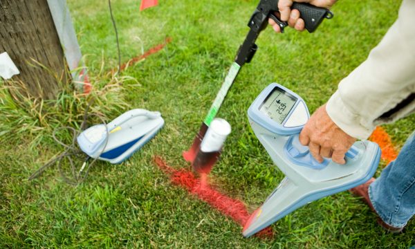
multiVIEW Locates carries out multiple utility locating contracts across the province of Ontario and is deeply experienced in navigating municipal standards and specifications. We use advanced techniques to accurately locate almost any type of buried asset including fibre communications, low and high-voltage electricity, high-pressure gas mains, water and sewer pipes, switches, pressure plates, and other complex infrastructure. We can also locate the “un-locatable” such as clay pipes or utilities containing broken tracer wires.

Improve understanding of municipal infrastructure lifecycle costs
multiVIEW Locates uses the most advanced Ground Penetrating Radar (GPR) solutions to examine subsurface conditions of bridges, roads, and highways to deliver insights into deterioration, cracking, delamination, corrosion, and other factors that may otherwise remain undetected. Revealing subsurface anomalies at the inception stage improves asset management by achieving a greater understanding of lifecycle costs, causes of deterioration, and the effectiveness of maintenance efforts throughout the aging process.

The multiVIEW Advantage
Expertise you can count on
Tap into a wealth of expertise to achieve highly reliable subsurface insights. Our dedicated Project Engineers and Senior Geophysicists will monitor processes and oversee the production of deliverables to ensure compliance and adherence to the highest standard of Quality. Our deeply experienced Technicians undergo comprehensive internal and external training as well as continued professional development to achieve certifications that include Damage Prevention Technician (DPT) and Electrical Safety Authority (ESA). And our certified CAD specialists will produce accurate drawings customize to your project needs.
Efficient mobilization, quick response times
From our various locations across Ontario, we mobilize quickly, even for distant deployments. Our unique approach to resourcing guarantees that a Field Supervisor is available 24/7 on every project. We save you time and money by coordinating all locates required for your project and working directly with Ontario One Call.
Diverse technology to get the job done
multiVIEW Locates invests in the latest technology available. We operate a fleet of state-of-the-art Ground Penetrating Radar (GPR) systems, Electromagnetic (EM) Induction units, Global Positioning Systems (GPS), Vacuum Excavation and coring equipment, Time Domain Electromagnetics (TDEM), CCTV Sewer Inspection cameras, and more. Learn more about our technology and techniques.
Premier in safety & quality
Our success lies in aligned interests with our customers that include a commitment to Health & Safety, a goal of zero work place injuries, and the systems in place to foster effective and transparent communication. Everything we do is guided by our Quality Management System (QMS) and Health, Safety & Environment (HS&E) Manual. We are also ISNetworld certified.


